- Services
- Road measurements
- Road bearing capacity (FWD)
- Roughness (IRI & IRI4)
- Rut Depth Measurements
- Pavement Skid Resistance Measurements
- Asphalt paving quality mapping (TGS)
- ITS & road information systems
- Road and Traffic Cameras
- Road Weather and Road Weather Stations
- Traffic counting
- Variable Message Signs
- Weigh-in-motion
- Trainings
- Contact
 ENG
ENG
- Services
- Road measurements
- Road bearing capacity (FWD)
- Roughness (IRI & IRI4)
- Rut Depth Measurements
- Pavement Skid Resistance Measurements
- Asphalt paving quality mapping (TGS)
- ITS & road information systems
- Road and Traffic Cameras
- Road Weather and Road Weather Stations
- Traffic counting
- Variable Message Signs
- Weigh-in-motion
- Trainings
- Contact
ENG
SERVICES
Road asset 3D mapping
The Challenge
Managing road assets like pavement, markings and traffic signs is complex, and without accurate data, problems are discovered too late. This leads to higher costs, more disruptions and reduced road safety.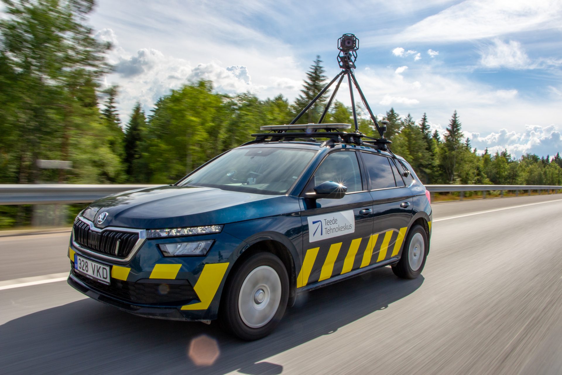
Our Solution – Infra360 Road!
Infra360 Road provides more precise and richer data than conventional mobile mapping, enabling evidence-based planning and efficient maintenance:
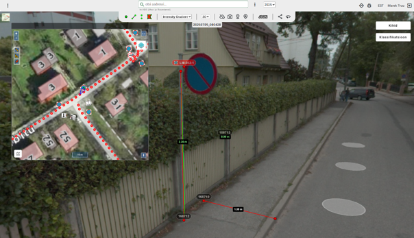
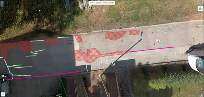
- Pavement defects: Mapping of 11 defect classes with accurate location, shape, and progression over time
- Traffic signs: Full inventory with type, size, orientation, and condition
- Road markings: Precise mapping of position, standard numbers, and condition
With annual data collection, Infra360 Road supports change tracking and helps prevent expensive repairs by enabling early action.
Our Advantage
- Higher accuracy and detail than standard mobile mapping
- Fast and wide-area data capture with 360° imagery, LiDAR, and AI-based recognition
- Seamless integration with GIS and BIM platforms
- Actionable insights for preventive maintenance and long-term planning
Key Benefits
- Better Planning: Reliable overview of all assets for prioritization
- Smarter Budget Use: Focus resources where they are most needed
- Preventive Maintenance: Detect issues early, reduce lifecycle costs
- Change Tracking: Monitor trends year by year
- Efficient Processes: Fast data collection and processing
- Improved Asset Management: High-accuracy datasets for stronger decisions
Who Benefits
- Road authorities & municipalities – dependable data for safer, longer-lasting roads
- Urban planners – accurate inventories to support mobility and infrastructure projects
- Road maintenance companies – objective monitoring and early defect detection
Get Started and contact us!
Get in touch
Road asset 3D mapping