- Services
- Road measurements
- Road bearing capacity (FWD)
- Roughness (IRI & IRI4)
- Rut Depth Measurements
- Pavement Skid Resistance Measurements
- Asphalt paving quality mapping (TGS)
- ITS & road information systems
- Road and Traffic Cameras
- Road Weather and Road Weather Stations
- Traffic counting
- Variable Message Signs
- Weigh-in-motion
- Trainings
- Contact
 ENG
ENG
- Services
- Road measurements
- Road bearing capacity (FWD)
- Roughness (IRI & IRI4)
- Rut Depth Measurements
- Pavement Skid Resistance Measurements
- Asphalt paving quality mapping (TGS)
- ITS & road information systems
- Road and Traffic Cameras
- Road Weather and Road Weather Stations
- Traffic counting
- Variable Message Signs
- Weigh-in-motion
- Trainings
- Contact
ENG
SERVICES
Asphalt paving quality mapping (TGS)
The Challenge
Asphalt durability depends heavily on the quality of paving during construction.
Time pressure, weather, and logistics make real-time quality control difficult. Without objective monitoring, defects appear quickly, leading to frequent repairs and higher costs.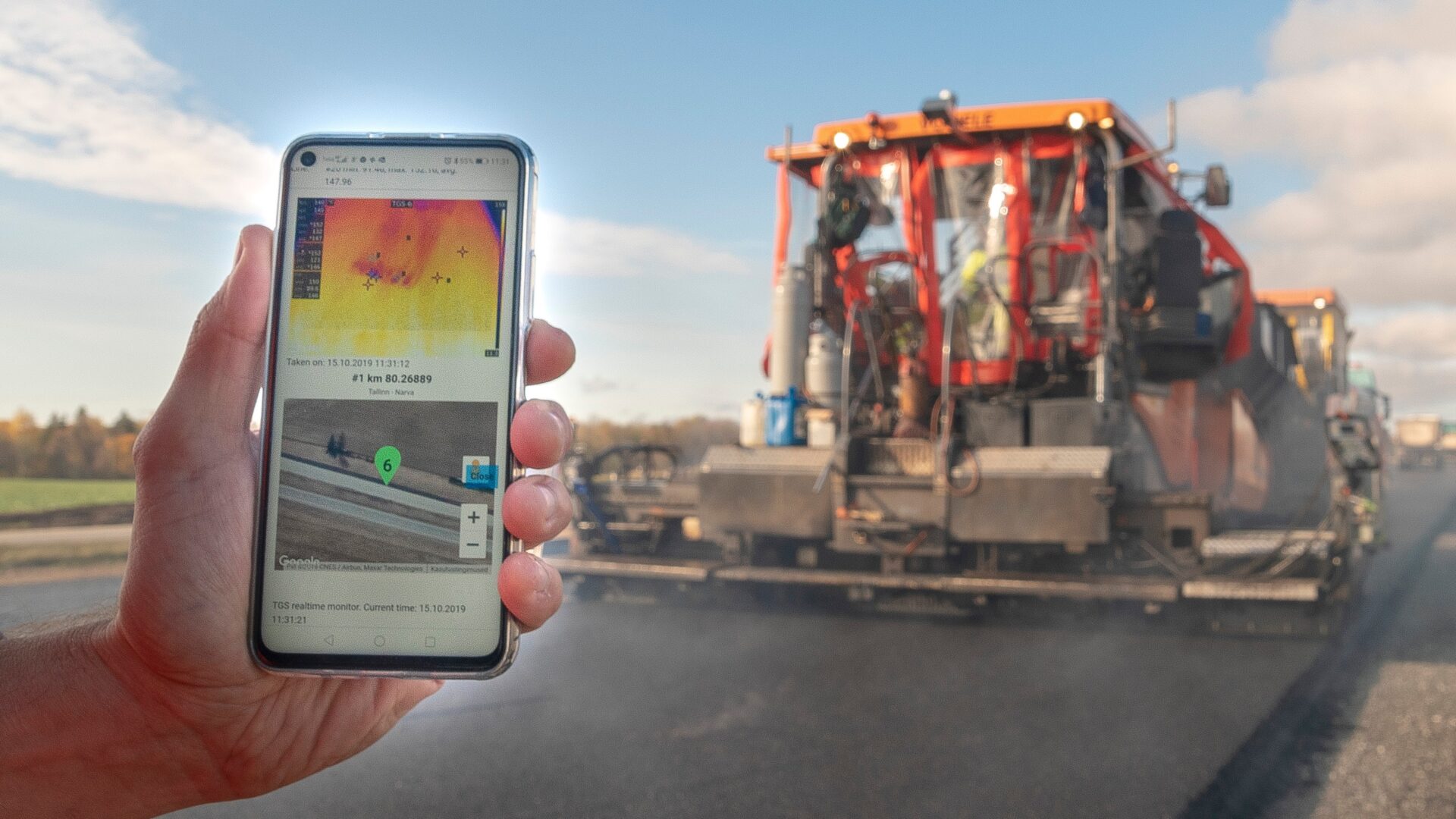
Our Solution – TGS – Data-driven asphalt paving for longer-lasting roads!
TGS is a thermal imaging and data system that measures:
- Asphalt surface temperature
- Paver movement, stops, and speed
- All linked with precise GPS coordinates
- And more
This provides real-time insight into paving quality for both the contractor and the client.
TGS is suitable for all asphalt pavers, regardless of the manufacturer.

Proven Results
- Used in 150+ national road projects since 2019
- Achieved up to 50% longer pavement lifetime
- Standard practice in Estonian state road contracts
- Supports bonus system to motivate contractors for higher quality
Who Benefits
- Road authorities – longer-lasting pavement, fewer repairs, reduced lifecycle costs
- Municipalities and cities – durable asphalt, less disruption, lower CO₂ footprint
- Road construction companies – objective quality data & fair incentive system
The device meets the following criterias:
PROPERTY
VALUE
The accuracy of the measurement location (odometer and coordinate).
±0.5 m along the road
Measurement width
> 5 m
Longitudinal interval (measurements per meter)
≥ 2
Transverse interval
≤ 0.3 m
Temperature information with location and time stamp
YES
Edge removal width
≤ 0.3 m
Measuring distance from the rear edge of the spreader
< 5 m
Real-time monitoring of installation temperatures
YES
Temperature measurement range
(25-175) o C
Accuracy of the device in temperature measurement
± 2%
Recording of thermal images/thermal carpet
YES
Spreader movement speed
YES
Let’s Build Longer-Lasting Roads Together!
Get in touch
Asphalt paving quality mapping (TGS)